Sophia Miller
GIS Portfolio
EDUCATION
Central Oregon Community College - A.A.S Geographic Information Systems with a focus in forestry and natural resources. Obtained June 2024BACKGROUND
Artist, general naturalist, and ornithology enthusiast from the heart of Texas by the Edward's plateau, though currently living in the central Oregon coast. I'm always looking for something new to learn and improve upon!WORK EXPERIENCE
- TDS Telecom, Telephone and Data Systems Inc. / Network Specialist GIS Analyst / November 2024 - Present
- TDS Telecom, Telephone and Data Systems Inc. / Network Specialist Intern / May 2023 - November 2024
- Central Oregon Community College / GIS Tutor / September 2023 - June 2024
- Digital Artist / Freelance & Hobby / July 2017 - Present
- Those Who Went Missing / Masterlist Management Team / February 2022 - February 2024
- Wild Birds Unlimited / Retail Associate / May 2021 - June 2023
Mapping Potential Golden-cheeked Warbler Nesting Sites
Golden-cheeked warblers (Setophaga chrysoparia) are a critically endangered species with niche nesting requirements in old-growth juniper forests in central Texas at the Edward's plateau. ArcGIS Pro's suitability model can provide insight into what could be the most likely locations to find these nesting warblers based on habitat types in Government Canyon state natural area. The intended audience for this story map was for the general public in Bexar county to raise awareness about this bird.
Central Oregon Community College 2023 Capstone Tree Inventory
The goal of the capstone class is to engage students in an independent project that is proposed to a hypothetical client, shareholders, and stakeholders. It is a collaborative process with other classmates. I had several responsibilities including, but not limited to; building a geodatabase and then configuring it to Field Maps, taking measurements using DBH tape for tree trunk diameter, and laser range finders to calculate tree height.
AFW Photography CC BY-NC 2.0 Deed Attribution-NonCommercial 2.0 Generic; https://www.flickr.com/photos/afwphotography/
COCC Indonesian Field study: Pangandaran National Park
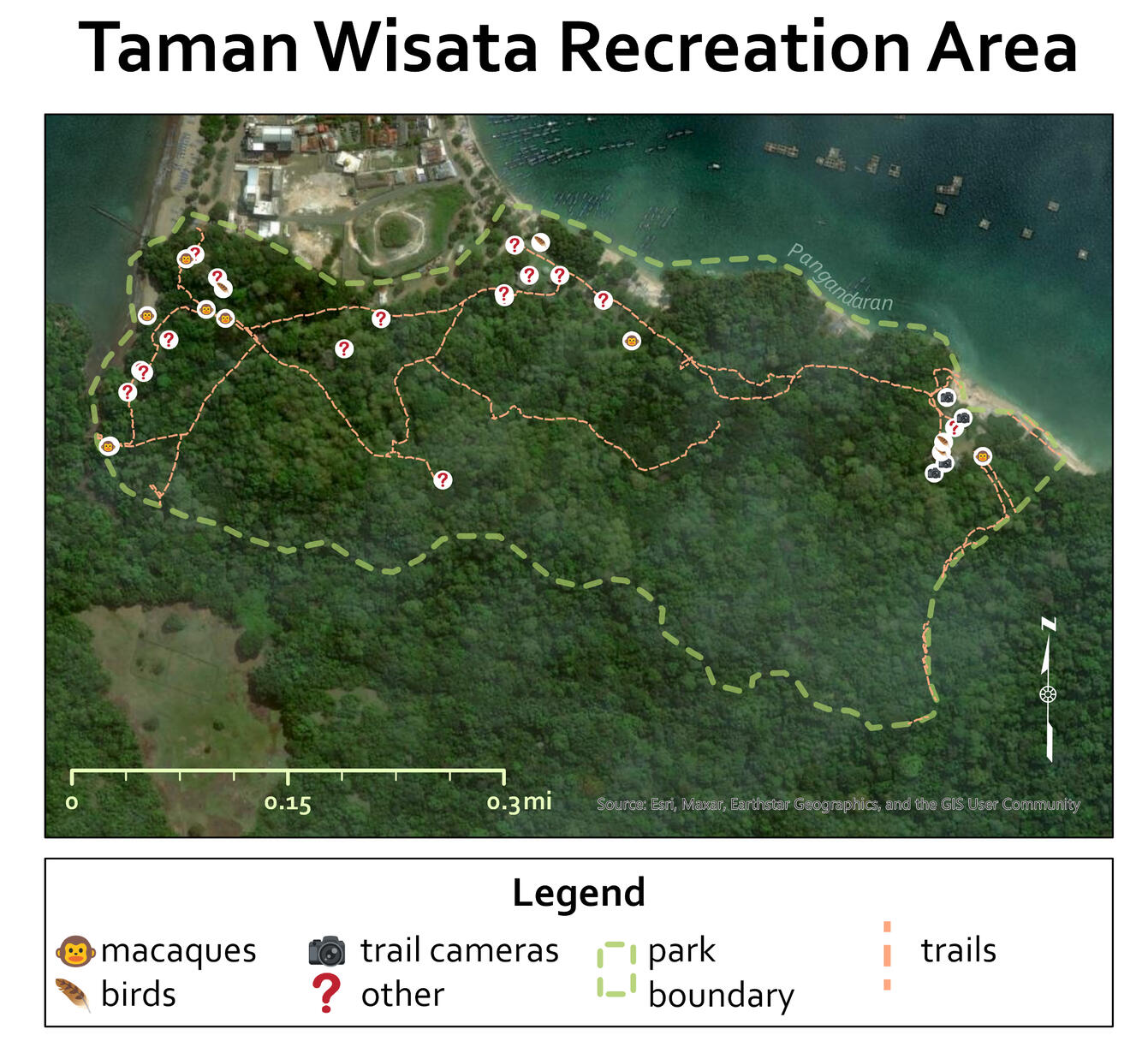
I prepared a geodatabase and subsequently a Field Maps app for students attending the COCC Indonesian field study to document various items of interests; the presence of people, different animals with macaques in particular, hiking trails, and along with a generic miscellaneous feature as well. A more polished layout of the map was made in ArcGIS Pro for the purpose of a paper written by the students.
Map Layouts
A gallery of various different map layouts prepared in ArcGIS Pro and QGIS.

COCC Indonesia Field Study: Pangadaran National Park. Made in ArcGIS Pro

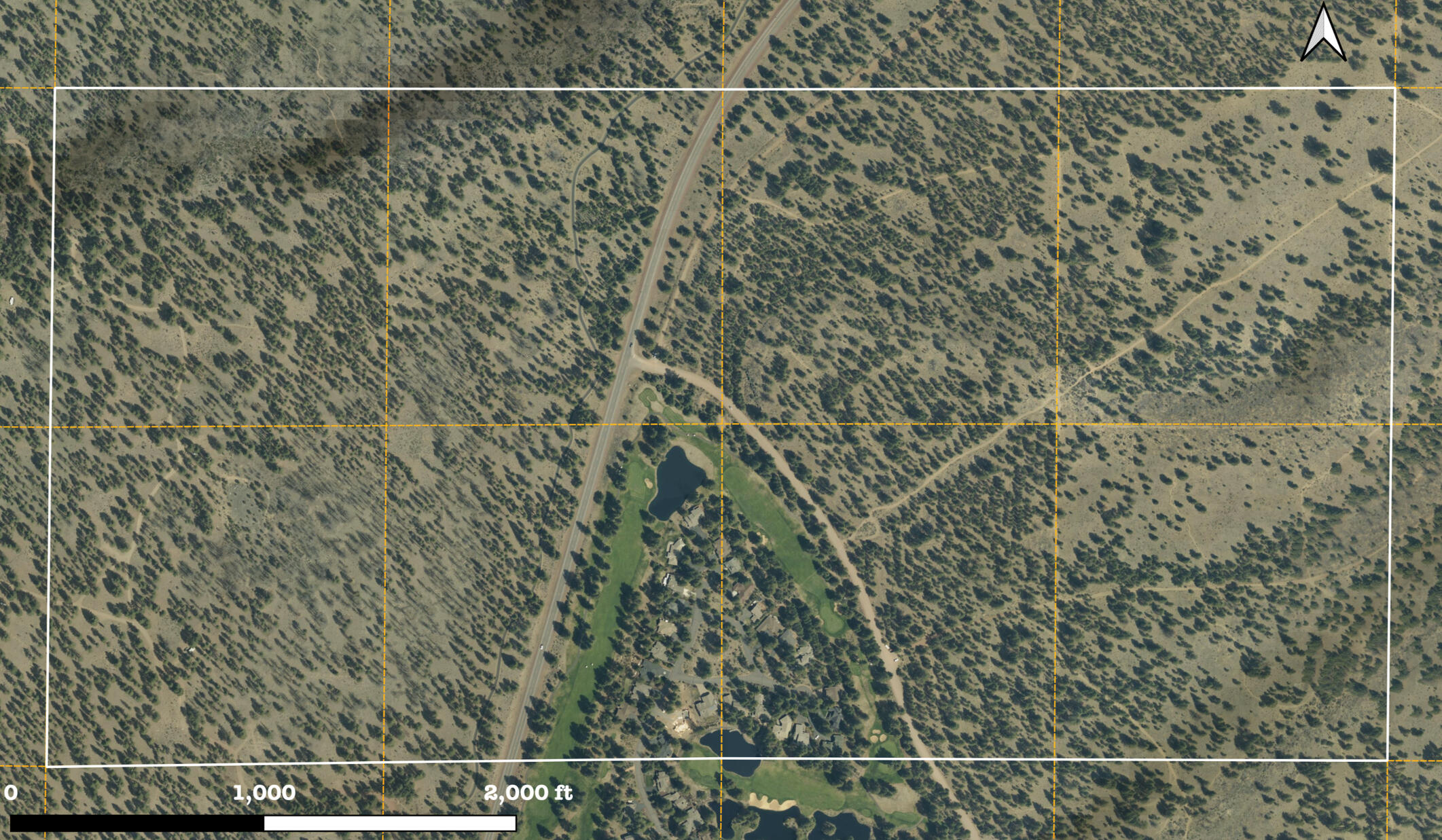
Study area requested by the COCC forestry department. Made in QGIS

A simple map for personal reference; the study area for an aerial photography class. Used in tandem with a hand-drawn map.

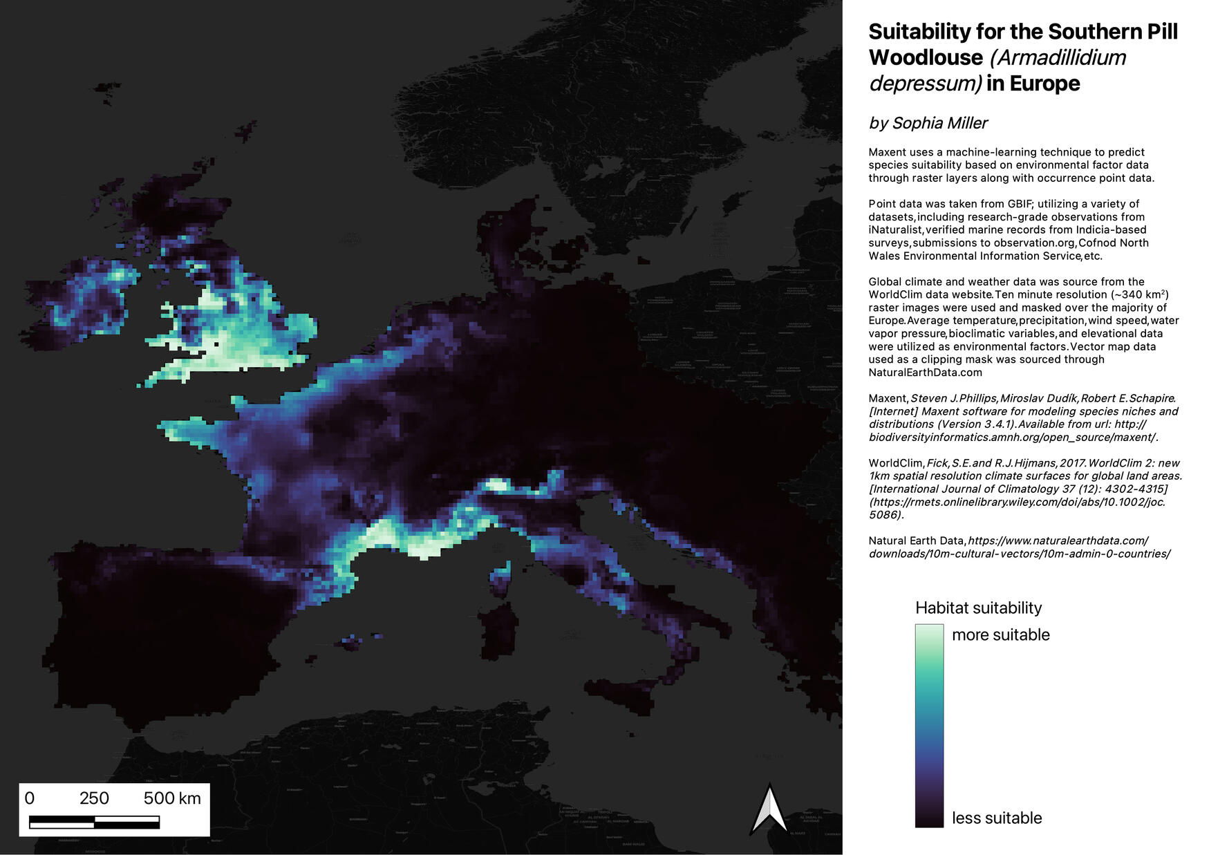
Suitability map for the Southern Pill Woodlouse - utilizing Maxent and WorldClim environmental data. Made in QGIS


